2015, July: Moby Dick and Proteus


Trip Report
Friday July 18, 2015. Fly to Calgary, meet David Nebel, drive to Golden. My crampons will not fit David’s boots. We find some used crampons in a shop and think they will work after some resizing (they do work).
July 19. Clear day. Meet guide Pierre Hungr at 8 am at the Alpine hangar and fly in smoothly to camp at Houston Lake. There is a large boulder with tent sites around it right at the lake shore; perfect. After setting up camp we climb to the ridge south of Houston Pass via some snow and ice to check all the gear, which works well. While traveling the ridge north to Houston Pass, David slips and his shin is pierced (through his pants) by a very sharp rock. Lots of blood. Pierre expertly dresses the wound with steri-strips and it heals well over the next few days, not really causing David any problems. But is was a very deep gash!
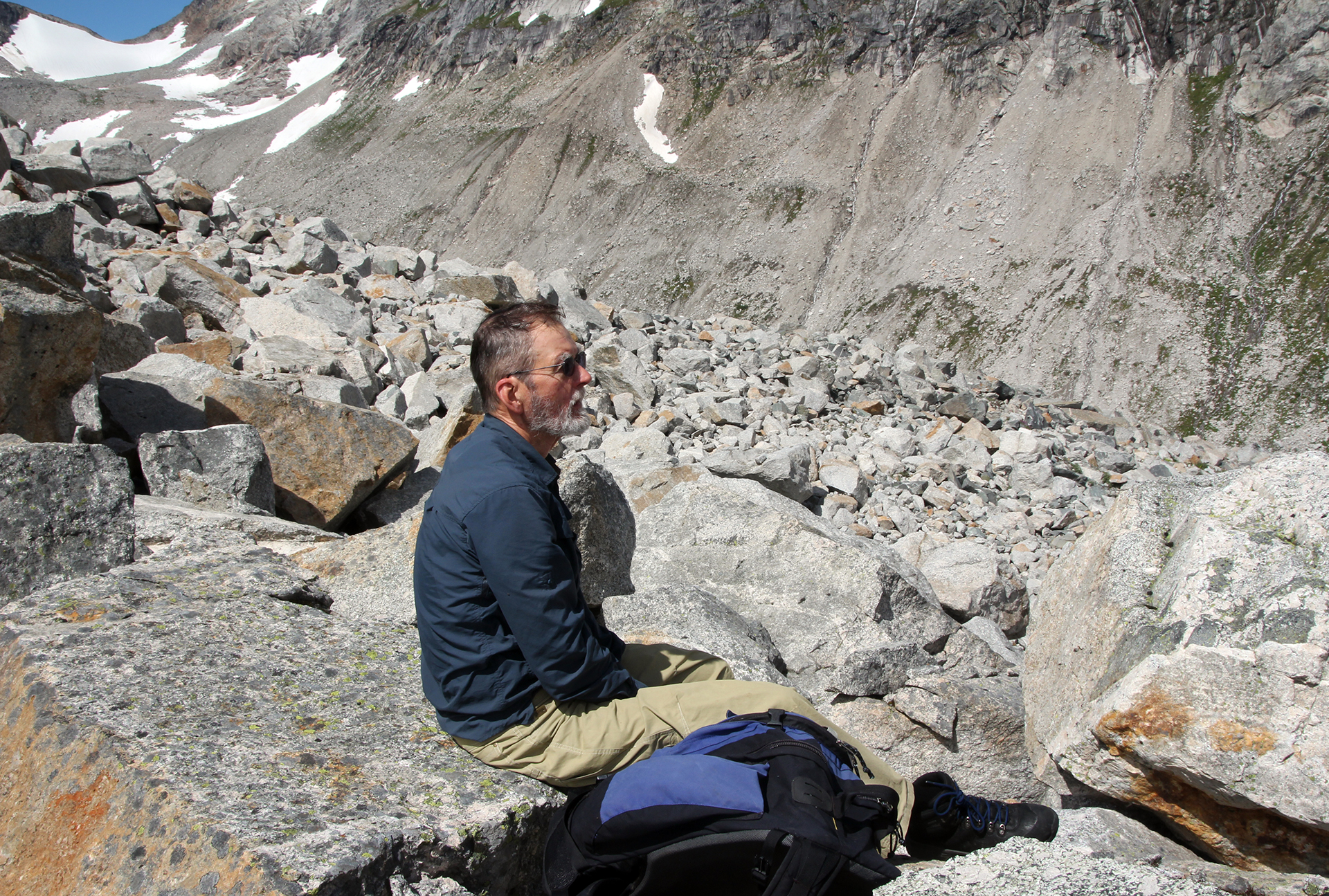
Sunday July 20. A little cloudy but we decide to go for Moby Dick by the standard south face route, pioneered by Sam Silverstein et al in 1959. Started at 6 am. The weather stayed cloudy, with no view of the summit, for several hours, but a few hundred feet below the top it cleared and we got decent views once at the top. The moraine approach was no problem. The slabs from the moraine to the ice were no problem. The ice was a problem as we had to zig and zag to avoid crevasses and at one point we needed a big jump, slightly upward, over an unavoidable crevasse. Pierre protected that with ice screws, one on either side. Then we had a section of clean snow that took us to the bottom of a long rock ridge. That went easily and we reached the final snow field to the summit ridge. From there it was an easy scramble to the summit. A register there showed climbs in 2005, 2009, 2010, 2013, so it appears the peak is not often climbed. We could see Battle Abbey well, and Butters Peak, but light clouds blocked the view west. The climb took 7 hours. On descent Pierre just lowered us on the snow, and it all went smoothly, though near the bottom we tried to avoid the crevasse jump, but had to do another wide one. We reached camp at 7:30 quite exhausted after a 13.5 hour day. And because of all the crampon work our feet were tired and sore. But we were elated to have gotten the prime objective for the week on the very first day.
Pierre observes that the wonderful ski down from the summit in good conditions would take about 15 minutes.
Monday July 21. Rest day. We did a short hike around the lake to see if there was an easy route up Claggart (there was not). Slept most of the afternoon. Weather was clear this day.
Tuesday July 22. We started at 6 am, aiming for the direct south ridge of Harpoon from Houston Pass, a classic route in the area. This forms the west end of the Harpoon Glacier. The rock was excellent; some loose, but also solid granite for climbing. David decided to stop about a third of the way up, and waited on a ledge as Pierre and I continued. It was a very long ridge, with many towers and lots of 5.4. At the top we stepped onto the upper glacier easily. A hidden part of a crevasse swallowed my lower half, but it was not a problem. After getting past that we decided that an attempt at Proteus (10660 ft) was more logical than the smaller Harpoon, so we climbed the glacier to that peak and scrambled to the summit. Just before the summit we could look down a couloir straight to our camp: fully 4000 feet. Awesome. The summit yielded great views in all directions, and it was pleasing to bag the highest peak in the area. Descent was slow as my knee tired (knee replacement in July 2014), but steady. Classically the descent is by the glacier, but that would not have been easy, so we descended the same way. David waited 5.5 hours and we all continued down easily and back to camp at 6:30 for a 12.5-hour day.
On snow below Houston Pass, David spotted wolverine tracks, and then we found a small piece of wolverine fur. He was headed to our camp. But camp was untouched!
Wednesday July 23. Another rest day, though with lots of rain. We walked around a little in the afternoon. This was the one-year anniversary of my knee replacement.
Thursday July 24. We went to Houston Pass and then left towards the notch in the transverse ridge off Billy Budd that was so critical to our ski traverse in 2004. David waited while Pierre and I went across a scree slope to steeper and loose rock (with some fixed ropes) up to the notch. From there the view to Stygian Pool and Scylla was fantastic. This was the exact point, and only cornice-free point, in the ridge that we came through in 2004 on our ski traverse from Snow Ocean to Battle Abbey. Easy return to camp where we packed up.
We were ready for the helicopter at 4 pm but at 4:30 a huge fog bank rolled in quickly, covering our whole valley. And then rain. It looked pretty bad. But a light lifting at 5:15 caused Pierre to text Alpine Helicopters that he thought it was okay. Despite heavy clouds and some fog the pilot (Mark) had no trouble getting in at about 6:00. He brought in another group of three to replace us. Surprising to me to see two groups here in two weeks. It was led by Jeremy Mackenzie of Kananaskis area.
Friday July 25. David and I took the gondola up Kicking Horse Ski Area for a nice high ridge walk for 2.5 hours. Spent night at the usual Super 8 near Calgary Airport, with dinner at Earl’s.
Saturday July 26. Fly to Denver. Lines at airport (United Airlines) were horrendous.
Post-Trip Research: First Ascender Sam Silverstein; Queen Elizabeth II visit to Golden; first map of the area by Sam.
Sam Silverstein spent the summer of 1959 exploring and mapping the Battle Range and ascending a number of its principal peaks. In July, he, Douglas Anger, and Fenwick Riley traveled on foot via Silent Pass to the Nemo Glacier, fording both the Duncan River and Houston Creek en route. They recovered airdrops placed in late June on the Nemo Glacier and made the first ascents of Mt. Nemo, the eastern summit of Evening Spire, and the eastern ridge of Mt. Nautilus.
Silverstein, Riley and Anger placed two air-drops: one on the Nemo Glacier and one on the Houston Glacier. Poor visibility, and the fact that their pilot, Charlie Thompson, had never been in the area, led Silverstein and Riley to mistakenly place a second drop on the large glacier on the southern side of the head of Houston Creek. Not until they reached the summit of Mt. Nemo did Silverstein and Riley recognize their mistake. “Well Doug, looks like we put the groceries in the wrong icebox.” For the rest of the summer Silverstein referred to this glacier as the Wrong Glacier and the peak at its head as Wrong Peak.
Having completed ascents of Nemo, Evening Spire and Mt. Nautilus, Silverstein, Riley, and Anger descended a steep snowfield at the western end of the Nemo basin (just below Feather Spire) to Houston Creek, crossed Houston Creek and traversed the alp-lands on the north side of Houston Creek to an alp below Mt. Moby Dick. From there they ascended Mt. Moby Dick. A two-day snowstorm caused them to abort their attempt on Mt. Proteus (then named Mt. Butters). With food supplies dwindling they crossed to Butters Creek, passing near the present site of Battle Abbey. Four days later they reached Silent Pass. The following day they reclaimed their car at the end of the McMurdo Creek road, and returned to Golden, B.C. It should be noted that Anger et al had tried Moby Dick in the summer of 1958. They did get Butters and Ahab, but retreated from a high point on the ridge between Pequod and Moby Dick. This earlier group named Moby Dick because of its aspect from Butters Creek. All this is well described in the 1960 issue of the Canadian Alpine Journal.
Silverstein spent the next week at the Hotel Fridham in Golden (whose owner at the time was one of the sons of either Walter or Edward Feuz), repairing equipment, purchasing and repacking food for an airdrop onto Houston Glacier, and waiting for two friends from Dartmouth: Charles Plummer and Thomas Marshall.
During this wait in Golden, a Harvard Mountaineering Club group arrived. The Harvard group planned to explore the Northern Purcell Range. Silverstein helped them pack food for an airdrop and shared the expense of the airdrop with them. They again employed Charlie Thompson who flew them over their respective airdrop sites in the Purcell and Battle Ranges.
Plummer and Marshall arrived in Golden in early August. Silverstein led the three over Silent Pass and up Butters Creek, and over into Houston Creek and to a small pond at the head of Houston Glacier. They recovered the airdrop Silverstein had recently placed, in the right place on the Houston Glacier this time, and waited for the weather to clear. It never did and for the next month they endured snow or rain nearly every day. This led them to name the site at which they were camped “Never-Sun-Col” (now known as Houston Pass). From this camp they ascended Mt. Scylla in one long day, using the west side of Billy Budd and the Chinese Wall. The continuous rain and snow prompted them to move camp to the valley of Oasis Lake. As they entered the valley the clouds parted and the sun shone. Tom Marshall commented, “A veritable oasis.” And so it was named. From their Oasis Lake camp they climbed into the Wrong Glacier basin, recovered the June air-drop, and ascended Wrong Peak. Two days later, in cloudy weather, they ascended the east ridge of Mt. Goodrich, which was named by Plummer in honor of the Dartmouth College librarian who had assembled a superb collection of mountaineering journals and books in Dartmouth’s Baker Library. The three then returned in an intense snowstorm to Houston Pass in hopes of climbing Mts. Escalade and Proteus. Snow and rain persisted for the next three days. On the fourth day, with the rain still coming down, Plummer announced he was getting dishpan body from sleeping in a damp sleeping bag, and was ready to leave the mountains. Marshall and Silverstein agreed and the three returned via Butters Creek to Silent Pass and their car at the end of McMurdo Creek.
Had the weather been better they would have attempted the Thumb on the Iron Ridge and Mt. Escalade. Nevertheless, it was a satisfying summer of exploration and climbing. Silverstein and Anger subsequently published a full description of the July and August expeditions in the Canadian Alpine Journal 1960. The article is illustrated with photos of the principal peaks of the Battle Range, and contains Silverstein’s map of the Range.
Sam continued as a serious expeditionary mountaineer for more than a decade: he was co-leader of a six-man team that in 1962 made the first ascent of Denali’s SE Spur and co-organizer of the American Antarctic Mountaineering Expedition 1966/67 that made the first ascents of Mt. Vinson, the highest point in Antarctica, and five other Antarctic summits. In 2006, the 40th anniversary of the American Antarctic Mountaineering Expedition expedition, Silverstein and three other members of the 1966/67 expedition returned to the Sentinel Range as guests of Antarctic Logistics and Expeditions. They placed a plaque on Mt. Vinson’s summit in memory of four members the 1966/67 expedition who were deceased. In honor of the accomplishments of the 1966/67 expedition the USGS Committee on Antarctic Place Names named the subsidiary summits of Mt. Vinson after each member of the 1966/67 expedition.
On the day preceding their July Battle Range expedition, Silverstein took this shot of Queen Elizabeth II, who was visiting Golden, B.C., on her first tour of Canada. Silverstein says he took it as an auspicious omen that the Queen of England came to Golden to see his expedition off!
Photos


Closer look at the ridge to Moby Dick.


